

At first glance, one might wonder about the connection between Artificial Intelligence (AI) and Geographic Information Systems (GIS). However, as you dig a little deeper, the synergistic potential of these two powerful technologies becomes clearer. The rapid ascendency of technology has thrown us into an era where information, particularly data, essentially directs our decisions.
As technologists, we’re always on the hunt for the next big thing, and I daresay, coupling AI with GIS is definitely it.
Geographic Information Systems, or GIS, is a conceptualized framework that provides the ability to capture, manipulate, analyze, and present all types of geographically referenced data. If this sounds technical & abstract, fret not. Think about Google Maps or Apple Maps that are handy on your smartphone; they are examples of GIS. But this is only scratching the surface – GIS goes far beyond just navigation and reaches into almost all sectors and industries.
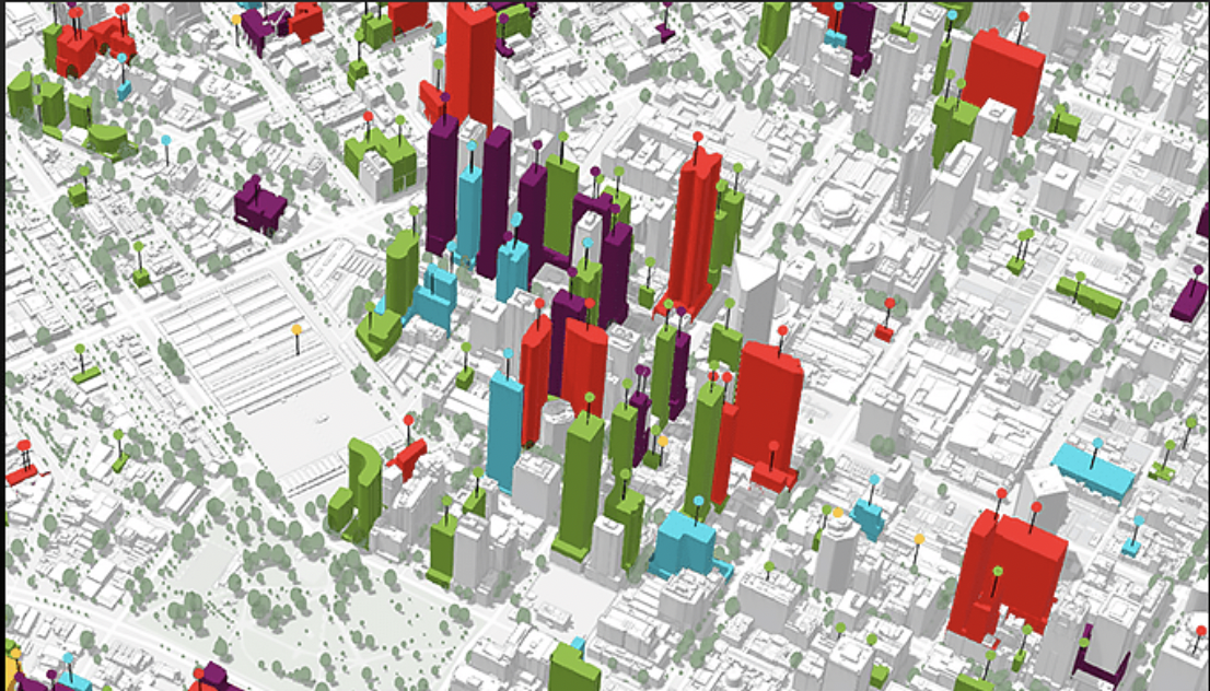
The power of GIS lies in its ability to visualize data as a map, interpreting datasets to understand patterns, relationships, and trends. This is a significant aspect for many industries, from government agencies planning urban development to e-commerce companies optimizing their delivery routes. These are considerable tasks, but they become much more feasible when geographical data is on your side.
Now, let’s introduce the hero of the story – Artificial Intelligence. AI is no stranger to any tech enthusiast. Its transformative potential is being realized across industries, automating tasks, accurately predicting trends & revolutionizing user interaction. Here’s a thought though – what happens when we combine the powerful visualization of GIS with the analytical and predictive prowess of AI?
The blend of these two technologies births a breed of highly advanced GIS, tipping the scales in problem-solving strategies & decision-making processes. Imagine being able to predict traffic congestion in real-time or forecasting the spread of wildfires more accurately. These are no longer mere aspirations; they are growing realities as AI-enhanced GIS technology continues to advance.
Of course, to make this fusion work, data plays a critical role. Both AI and GIS are heavily reliant on data, but not just any data, it needs to be reliable & accurate. Therefore, the successful integration of AI with GIS is largely dependent on data quality before it can work wonders in its operational environment.
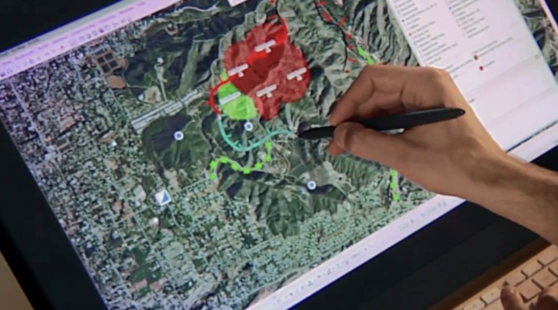
Once the required data feeds into the system, GIS can map and visualize it, and AI can learn from it, identifying patterns & making predictions. An essential benefit of this integration is its potential in predictive modeling. Real-time monitoring and predictions are of substantial value in crisis management, especially in areas prone to natural disasters.
Climate change has ushered in an era of unpredictable weather patterns and increased incidents of natural disasters. Harnessing the power of AI-enabled GIS can significantly improve how we handle these situations. For instance, in forecasting the spread of bushfires or hurricanes, the technology can model different scenarios based on real-time data, helping authorities implement effective, prompt response strategies.
In the realm of urban planning, integrating AI with GIS can create more efficient, sustainable living spaces. AI can analyze countless data points, including traffic flow, population density & energy demand, presenting them through GIS for clearer comprehension. Planners can use these insights to design urban spaces that emit less carbon, reduce traffic congestion, and are generally better suited for their inhabitants.
Beyond urban planning, AI-enhanced GIS can work wonders in the field of healthcare as well. For instance, during disease outbreaks, tracking & predicting the spread becomes crucial. AI comes into play here, analyzing geographical, demographic, and health data to understand how the disease might progress, allowing for more accurate resource allocation & public health planning.
Another fascinating area where AI and GIS converge is in agriculture. Precision farming, facilitated by AI-powered GIS, can revolutionize how we grow our food. By closely monitoring crop health, predicting weather patterns & managing water resources, farmers can make more informed decisions that boost productivity while ensuring sustainability.
Both AI and GIS challenge the boundaries of what we currently know and what we can achieve. Sure, there might be apprehension such as privacy concerns and uneasiness about AI taking over too many aspects of our daily lives. However, the potential benefits are undeniably vast, nudging us to negotiate these apprehensions.
It’s true, unlocking the full potential of AI & GIS integration calls for extensive research and thoughtful implementation. But as we’ve seen time and time again, whenever technology advances, it carries the human race alongside it. We are on the threshold of a new era, and harnessing this AI-GIS combo could redefine how we perceive and interact with our world.
The promise of a better future is seen in health crises being managed more effectively, farming that leans towards sustainability, climate change-related disasters being dealt with more preparation & urban spaces becoming more livable. Essentially, Artificial Intelligence-enhanced Geographic Information Systems can guide our responses proactively and systematically, instead of us reacting in a fragmented and sporadic manner each time.
So as we navigate the thrilling pathways of technology at the wake of this new decade, let us not forget the alliances it forms along the way. GIS, strengthened by the muscle of Artificial Intelligence, could be the guiding compass pointing us to a future defined by data-informed decisions & strategized responses to pervasive problems.

